Nanosatellite technology to revolutionize climate change management
A pioneering Finnish nanosatellite has now reached space equipped with the world’s smallest infrared hyperspectral camera. The photos with infrared data taken from the satellite provide new solutions for monitoring and managing the effects of climate change. The hyperspectral camera is a trailblazing innovation from VTT Technical Research Centre of Finland. The Reaktor Hello World nanosatellite was launched into space on November 29th by the Finnish space technology startup Reaktor Space Lab.
In the past, hyperspectral imaging – the simultaneous collection of the optical spectrum at each point in an image – was feasible only with larger, exorbitantly priced satellites. The larger satellites also came with significant restrictions: a single satellite provides new data only when passing over a specific location and produces new imagery on several-day intervals.
New tiny nanosatellites, such as the Reaktor Hello World satellite, weighing only a couple of kilograms are relatively cheap and fast to build. In groups, nanosatellites can form cost-efficient constellations. With the help of the new Finnish imaging technology, nanosatellites are now able to collect critical, nearly real-time data on the state of our planet. That development has far-reaching benefits for monitoring climate change.
The groundbreaking innovation comes at a pivotal time as climate change continues apace. “This particular type of imaging data makes it possible to monitor the status of carbon sink resources. It also enables optimization of food production and reducing environmental load caused by agriculture, providing a way to sense water irrigation needs and optimize the use of fertilizers in fields,” says Anna Rissanen, Research Team Leader at VTT.
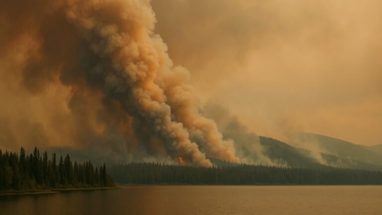
Unique hyperspectral data can help predict natural disasters such as forest fires
The infrared wavelength region shown by the hyperspectral imager contains a significant amount of data. That data can be used to recognize ground targets such as fields, forests, mines or built infrastructure and analyze their features based on unique spectral fingerprints. Such features could be related to the presence of chemicals like fertilizers, biomass content or rock species, for example. Hyperspectral imagers can also monitor vegetation health and the composition of greenhouse gases.
“This new technology will allow us to react to global environmental changes in near real time. That opens up many new business opportunities as well as ways to combat climate change,” says Tuomas Tikka, CEO of Reaktor Space Lab, Reaktor’s portfolio company that specializes in building advanced nanosatellites for space-based services.
The first images were taken on 2nd of December over the Sahara desert and they were downloaded from the Reaktor Hello World during the first weeks of December.
”The image above Sahara (Figure 1) shows how the water content of an area can be determined and mapped based on infrared spectral image data,” explains Antti Näsilä, Senior Scientist at VTT and the leading technical expert for the camera development of the Reaktor Hello World nanosatellite mission.
“This type of information could prove crucial for areas fighting drought or forest fires, both of which are becoming more common with the changing climate. In the future, nanosatellite constellations could provide, for instance, concurring updates about the severity of the droughts in each neighborhood in California”, says Näsilä.
The infrared hyperspectral imager on board the Reaktor Hello World nanosatellite is a small, lightweight, 2D-snapshot tunable spectral imager operating in the short-wave infrared spectra (900–1400 nm). The world’s first nanosatellite compatible hyperspectral imager built by VTT was launched on board the Aalto-1 satellite in June 2017, demonstrating hyperspectral imaging for visible and VNIR range (500 – 900 nm). Now, the technology has successfully been extended to cover also the infrared range. In the future, the team believes that this hyperspectral imaging technology can bring completely new solutions for space exploration.